Yuma Score, Imperial Regret
May 27th, 2019 – eastern Colorado & southwestern Nebraska. Most chasers know this day as ‘the best structure of 2019’ or ‘the best structure of my life’. I know it as ‘stupid roads that lead to nowhere’, ‘low fuel’, and ‘don’t say the “I” word around me again’. So I just call it Yuma Day.
Waking up in Denver Colorado with a chase target just outside of DIA is a truly magical experience, nothing like fresh mountain air in the morning, just 10 miles outside of your chase target.
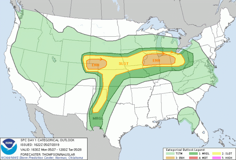
After chasing the day before in eastern Colorado and scoring a distant, messy, rain-wrapped stovepipe near Keensburg, Colorado, we were ready to score again in relatively the same area. The SPC issued an Enhanced risk for northeastern Colorado into southeastern Wyoming and southwestern Nebraska.
Side note: That IL Warm Front though…. this was Dayton, Ohio Day.
It would be difficult avoiding chasers today, unlike the previous day but we would try our best. By noon storms were already initiating just east of the foothills, west of DIA, and were showing supercell structure right off the get-go. Though these early storms were very strong and chaseable, they were EARLY and posed a great deal of concern about whether we would see the day’s full potential.
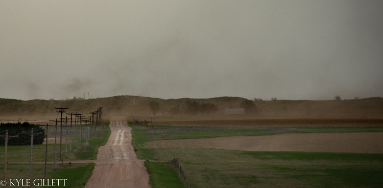
The early storms on this day were very messy and made for difficult spotting. They were rather unphotogenic so we opted to remain close to the area that was off and on showing signs of low-level rotation. Eventually, we were paralleling an area of rotation that we considered not to be related to the parent storm’s mesocyclone or even its main updraft because this storm was so messy and unorganized on the larger scale. Visually we could make out a very small area of rotation and eventually as we were driving up next to it, a sudden and very brief lowering kicked up a large tube of dust that made it roughly 1/3 of the way up to the base. By the time I got the camera ready (in the moving car) the lowering had mostly retreated back into the larger bowl lowering it came down from, but the circulation and the plume of dust remained just long enough for a few photos.

Shortly thereafter, this area of rotation seemed to get increasingly more muddied and messy. We chase these early supercells for a couple hours or so. We eventually decided to leave the messy, hyper-drive, linear junk-fest. We blasted eastward to a few new, young sub-20 dBz radar bins south of Yuma County, Colorado. It was a very difficult decision on whether to leave the storms already in progress, on a boundary for a few sprinkling towering cumulus or not, but after some careful analysis, we found that the environment still supported supercells and tornadoes in the open warm sector. The only problems seemed to be an uncertain initiation and sustainment of updrafts due to an overall lack of moisture.
Upon arrival in Yuma, Colorado our little shower was showing signs of being the real deal!

We could see early that low-level moisture was going to be an issue. We sat next to the railroad that passes through Yuma for some time waiting and watching this young storm develop signs of becoming a supercell. Just in time for a train to pass – a shot of a lifetime. Hoping for another shot like this soon!
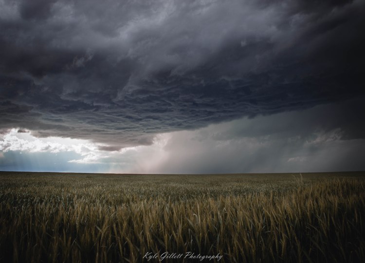
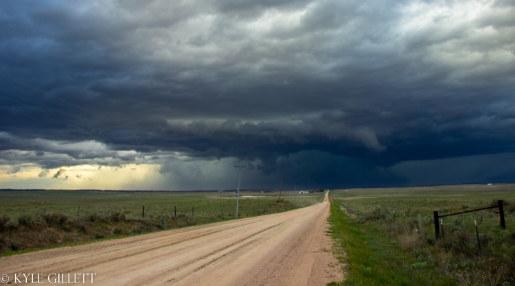
 This storm for the longest time had an enormous, flat, rain-free base and we grew worried that this storm wouldn’t be able to overcome dry air at the surface. The storm remained LP for the first hour, hour-and-a-half of its existence.
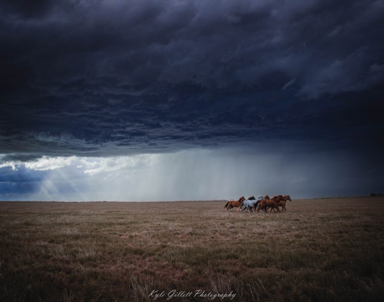
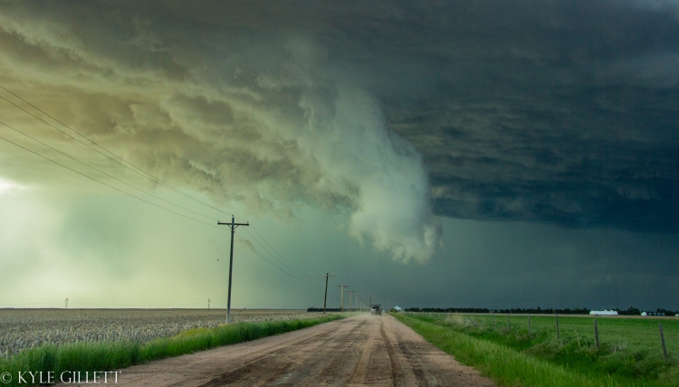
At one point while standing outside of the vehicle watching the storm and discussing possible movement options, big gusts of inflow blasted at our backs. The second strongest inflow I have ever felt. After 10-15mins of the most gnarly breaths of inflow, we finally had a few lowerings and a wall cloud.
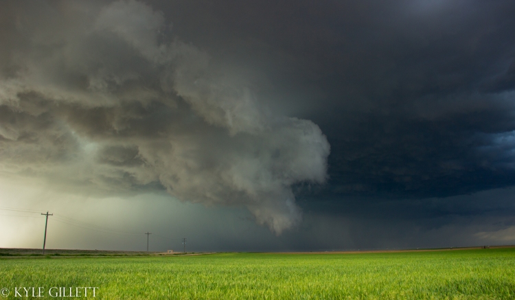
(throwback to my old, less attractive edit style^). Even with a new wall cloud and our storm pumping our more forward flank precipitation, she sure was still high-based and dry. The wall cloud was incredibly sculpted and the RFD, though visible, was very dry. The chances of a fully condensed tornado were slim.


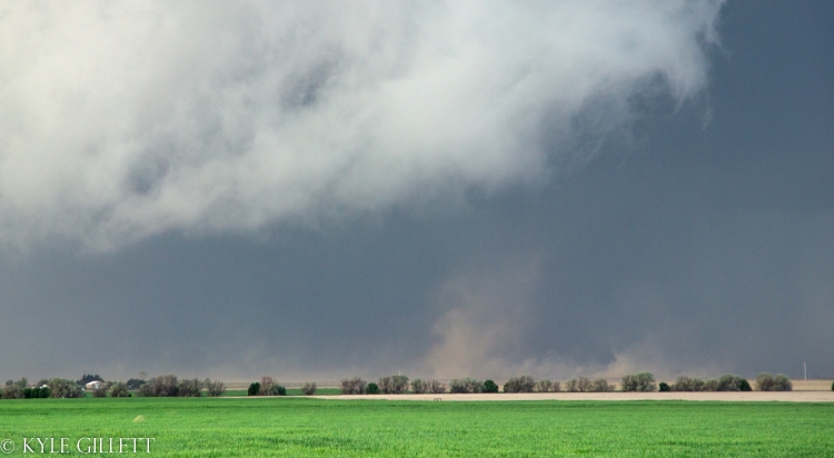
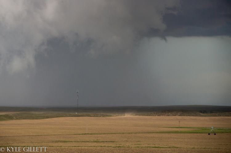
And as fate would have it, just as this storm was gaining some strength, the road network was getting rough. We began to fall behind as the storm was also gradually picking up speed. During our time of catching up, this storm dropped multiple brief, weak dust-swirl, tornadoes. We pondered for a while if they were tornadoes but after a close examination, tighter circulations within the cloud base directly above the dirt swirls would suggest they may have been numerous brief tornadoes that were incapable of becoming fully condensed. This idea was also suggested by other chasers around the area, but who knows. Count it?
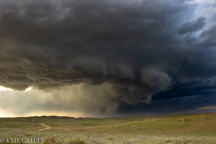
And then it happened. Random open range-land full of horrible roads, cows, and a storm blasting away from us. We worked hard to catch back up with the storm and eventually did for a brief moment before a gustnado and a huge rush of RFD that produced heavy blowing dust. But just before arriving, I glanced at radar and saw a new cell developing to our southwest, near Wray, Colorado. At one point, I had gotten out of the vehicle and looked behind us at the new cell developing at looked to have some very small mid-level striations… interesting, I recall thinking to myself.
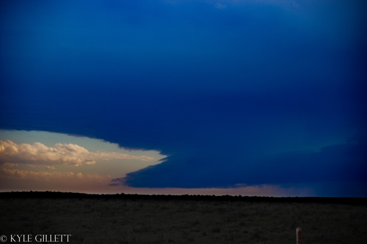
Yup, that very highly edited image below is the ‘I-word’ monster with some mid-level striations still in Colorado. We had every plan to get east and in place for that storm but, roads going into Nebraska in Yuma County were basically zero, and we needed gas. There were two interstates nearby that would go into Nebraska. Route 34 to the south in Wray, putting us way out of position to the south as the storm was already northeast of Wray. There is also Route 6 out of Holyoke, which also had the nearest (basically only) gas station. But there was one other option. A random, nameless dirt road that a local told us would “cross into Nebraska under them power lines” – long story short, this nameless two-track mess did not make it into Nebraska. It basically turned to prairie about a half-mile short of the border.
Being low on fuel, out of road options, and the sun starting to sink – it was time to give up. We headed up to Holyoke for fuel and back to then back to Denver just to open our social media and find photos of the most incredible structure…
