June 19th, 2025 was “the day before the day”. “The day” of course being June 20th, the day the US broke it’s 13-year-long EF-5 drought with the Enderlin, North Dakota tornado while a historic derecho was also raking the state. While the day before is not nearly as well known or historic, a large dusty wedge tornado from a lone supercell thunderstorm would damage homes and properties southwest of Dickinson, North Dakota.
The NWS Storm Prediction Center would maintain a Slight Risk for severe convective storms in southwestern North Dakota at 2000 UTC that afternoon which included a 15% risk for damaging thunderstorm winds and for damaging large hail along with a 0% risk of tornadoes.
That morning started with work and meetings back in Grand Forks. I’d hit the road shortly after 1700 UTC and make it into southwestern ND by 2200 UTC where initiation was taking place.
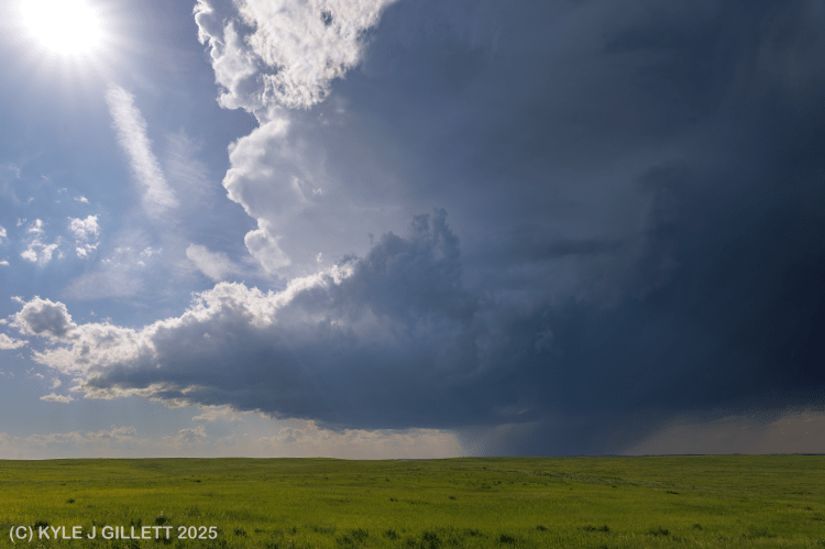
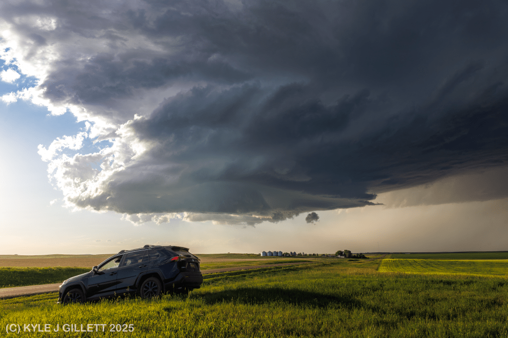
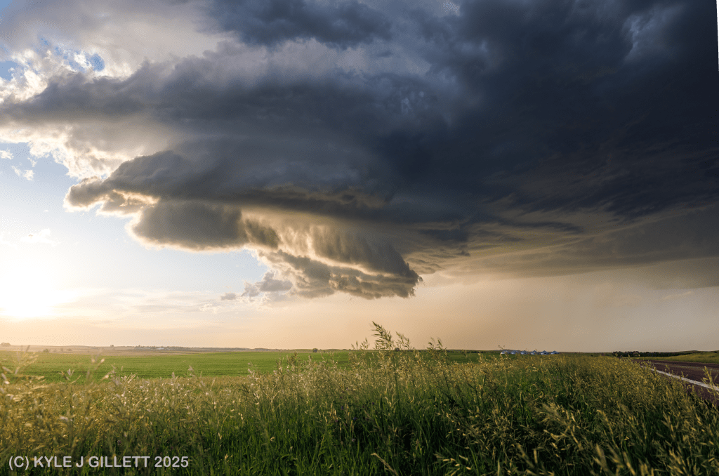
2305 UTC – north of Belfield, ND: Looking northwest towards the edge of Little Missouri Badlands where a young low-precipitation supercell is expanding the area of its elevated rain-free updraft base and enhancing its forward flank downdraft precipitation core. The cell first developed further northwest just east of Knife River, Montana along the MT/ND border shortly before 2200 UTC. A few cells could initiate and congeal over the badlands over the next hour. At this time it has been warned for 60 mph winds and 1.5″ hail.
2312 UTC – northwest of Belfield, ND: Looking north at an evolving young supercell as it crosses from the badlands to the plains. The updraft base is quite a bit larger but remains elevated. The forward flank has expanded and grown heavy, producing severe hail. At this juncture, I decide to give this storm some room as soon I will have to cross the west-east running interstate-94 with limited options to do so. I drift back east after this photo to a N-S option to cross I-94 through the town of Belfield.
2324 UTC – north of Belfield, ND: Looking west northwest just before crossing I-94. Cloud to ground lightning has increased by this point, the forward flank has continued to expand and the base is even beginning to lower some. There may even be a hint of a weak rear-flank, or far left flank precipitation core developing. The storm has a Considerable Severe Thunderstorm Warning for 2.00″ hail.
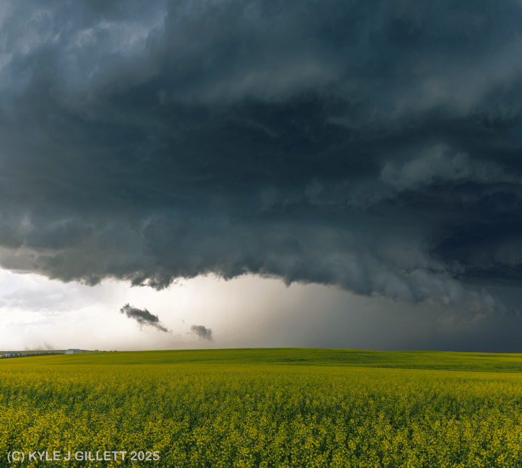
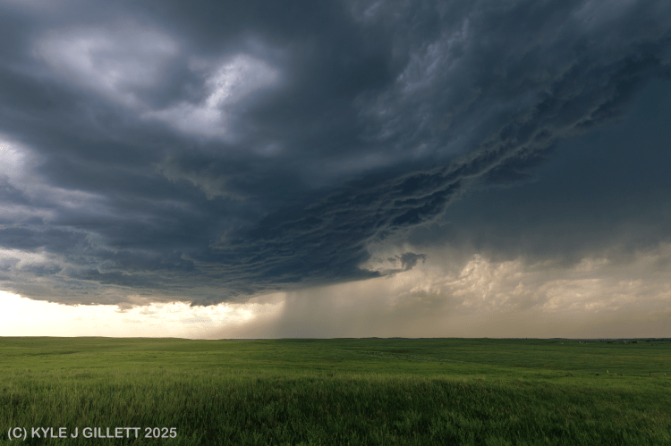
2358 UTC – southeast of Belfield, ND: Looking north a lowering updraft base after repositioning south of I-94. This supercell still has a Considerable Severe Thunderstorm Warning for hail up to 2.50″. The updraft base has taken on a somewhat bizarre appearance, becoming elongated long the axis of the forward flank gust front. At this point the rear-flank downdraft is improving, but generally invisible in the storm structure. The only sign of the RFD here is a plume of dust being kicked up just north of Belfield (lower left of the photograph above). This will soon become the RFD surge that initiates tornadogenesis.
0016 UTC – south of South Heart, ND: Looking north-northeast at a sculpted, rain-free low-level mesocyclone with weak ground circulation. The situation rapidly evolved between 0000 UTC and 0015 UTC. The aforementioned RFD surge would begin swinging around the west and southwest side of the previously quiet updraft base by 0005 UTC. Inflow would markedly increase over the next 5-10 minute period and a tornado warning is issued by NWS Bismarck at 0009 UTC following a rapid change in storm behavior. Between 0008 UTC and 0012 UTC, I was traveling east, aiming for a south option to reposition further southeast and watched the initial circulation develop within 1/4 mile north of my location on 43st St SW. A weak vortex, likely along the RFDGF crossed the road within a couple hundred yards of my vehicle just before taking the south road option. That vortex would merge with the growing circulation to my north. After taking the south option, 122th Ave SW, I achieved a safe distance and stopped at 46th St SW at 0016 UTC and was greeted with this view. The responsible RFD surge was impressively dry for the cut it created around the mesocyclone’s backside.
0019 UTC – south of South Heart, ND: After repositioning east down 46th St SW, looking north-north east at a broad multi-vortex circulation kicking up dust around 1 mile away. Hard to ask for better lighting and a better foreground than this.
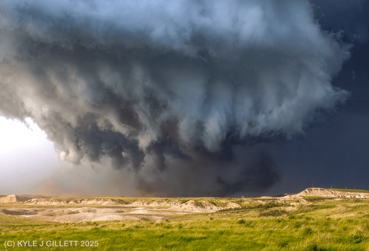
0019 UTC – south of South Heart, ND: Only 30 seconds later a far more ominous multi-vortex structure develops and more dust is lofted.
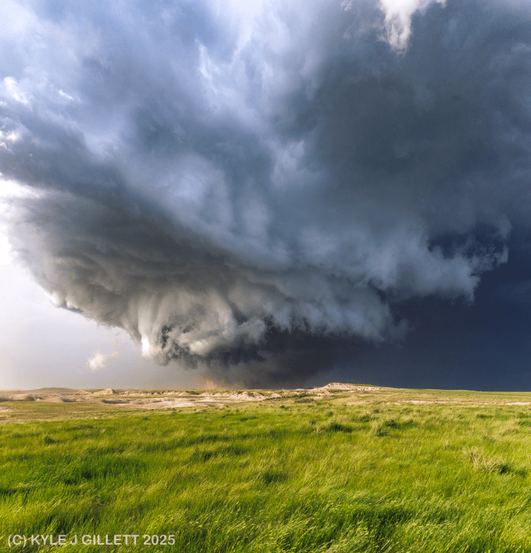
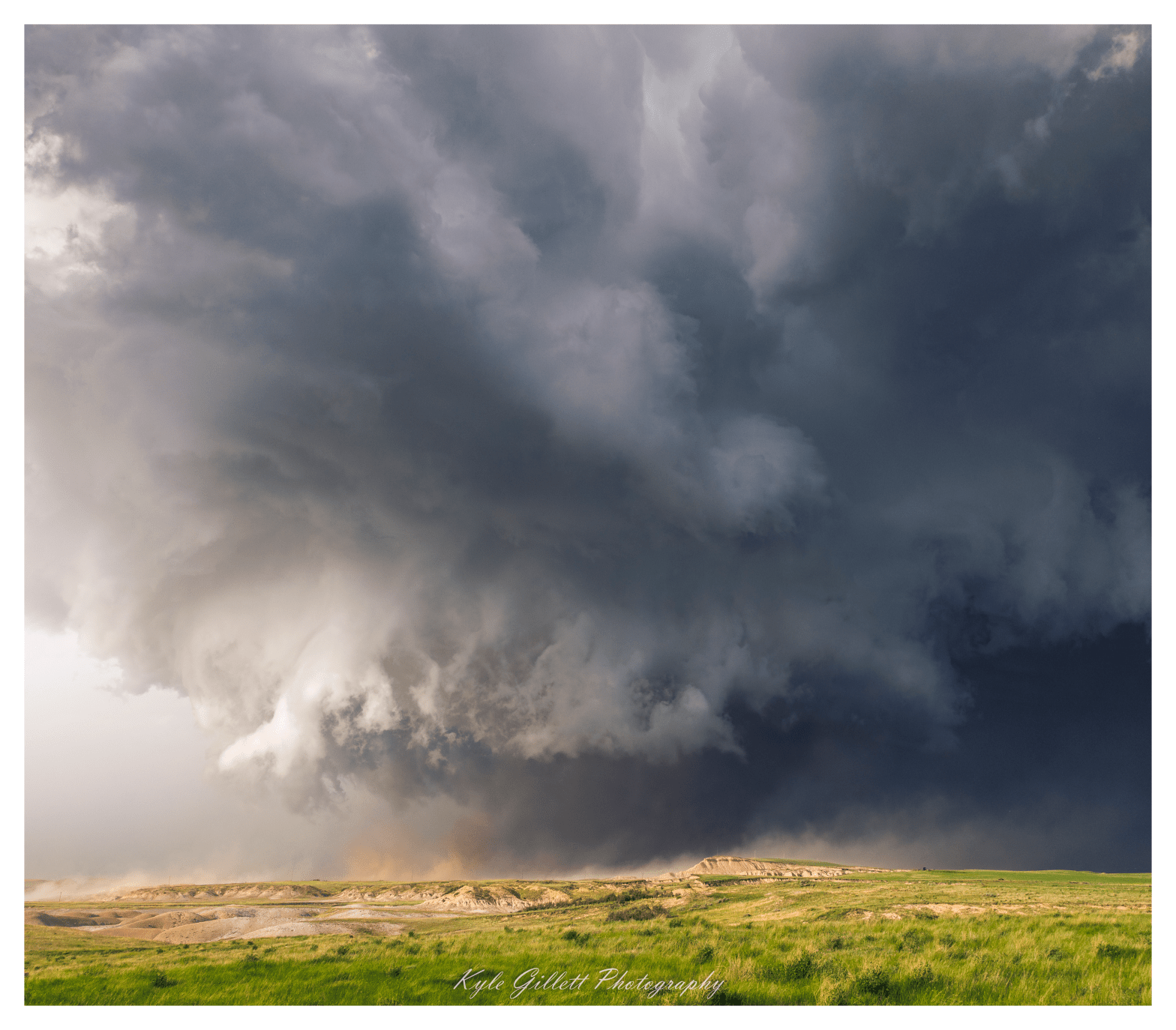
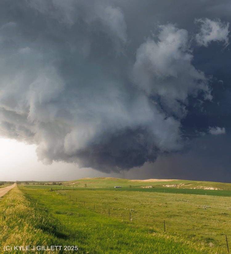
0020 UTC – south of South Heart, ND: A two photo vertical panorama image of the large, dusty, multi-vortex circulation around 1 mile north of my location on 46th St SW. The circulation was quite large the entire lifetime of this tornado, but a more consolidated stovepipe-shaped dust-filled vortex lives deep in the circulation in the middle of the frame above.

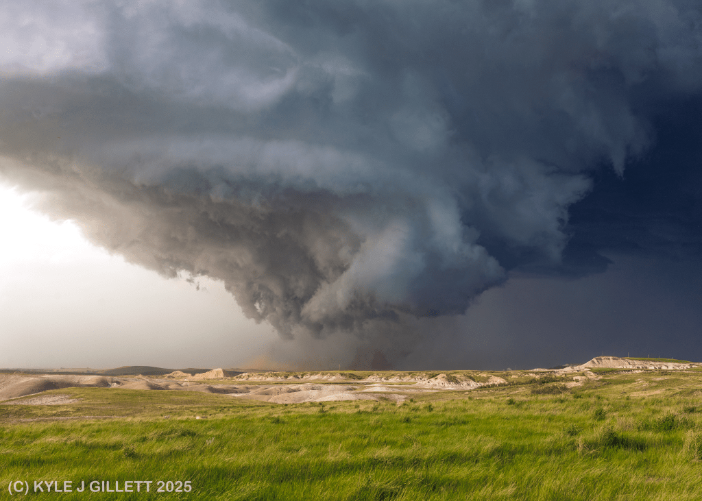
0021 UTC – south of South Heart, ND: still looking north-northeast at a remarkably well structured low-level mesocyclone that is nearly becoming detached from the parent storm. At this point a new internal RFD surge is rapidly advancing around the mesocyclone (as seen by dust in the lower-left of the photograph). The size of the tornadic circulation was immense at this time.
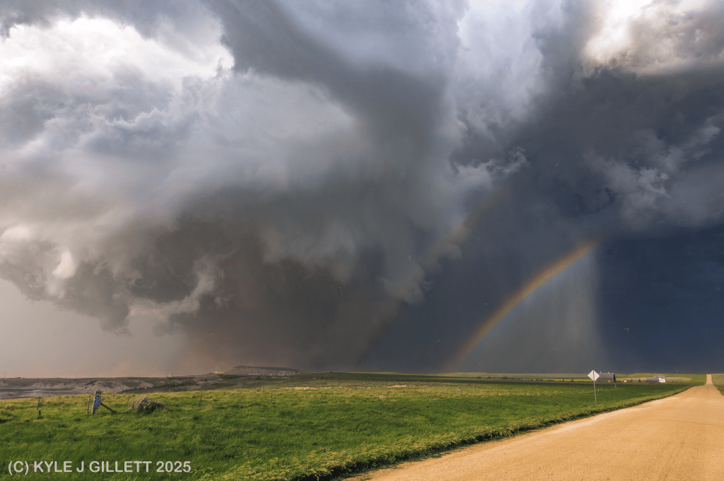
0022 UTC – south of South Heart, ND: Within just one minute of the last photograph, another drastic change has taken place. Rain and dust have passed over my location on 46th St SW (see distorted rain dropped scattered throughout the image) behind the very turbulent aforementioned internal RFD surge. Contrast was beginning to wane here but a tornado-double-rainbow shot is always welcome.
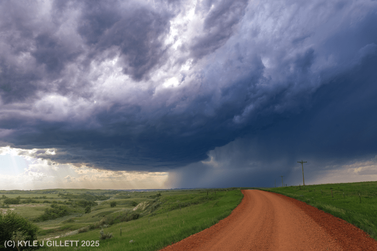
0042 UTC – west of Regent, ND: Looking northwest at the now distant supercell thunderstorm after producing the wedge tornado. Shortly after the last photograph, the RFD would become increasingly intense (rain, dust, wind) and the road heading east was likely to dangerous to travel quickly given the conditions and looming threat of RFD hail. Given that visibility of the large slow moving circulation had dramatically decreased by this time, the safest option was to bail south, connect with the nearby paved highway and get east. This photograph comes from ND-21. I would remain on ND-21 headed east for quite some time to catch back up with the storm.
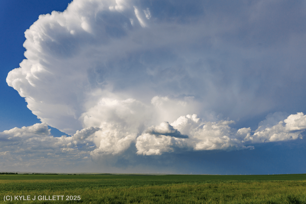
0130 UTC – north of Mott, ND: looking north-northwest at now stable, shrinking supercell that was once responsible for producing a massive wedge tornado. I would sit atop this hill on ND-8 a mile north of Mott, ND for some time watching this supercell churn as it slow meandered southeast. On a few occasions it would feature a meager RFD cut through its skinny mesocyclone, but it simply wasn’t strong enough to produce again.
0211 UTC – south of New Leipzig, ND: looking north at the decaying – yet somehow still hanging on – low-precipitation supercell crossing ND-49 a few miles south of New Leipzig. Despite being in a state of decay for over an hour, this supercell never ceased to put on a wonderful show.
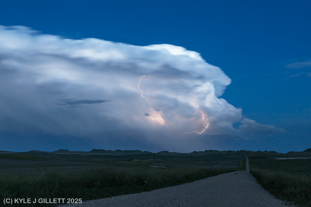
0339 UTC – east of Lark, ND: Even well over an hour later this supercell continued it’s southeastward march towards the ND/SD border. It’s seen here looking south-southeast from 44th Ave SW off of ND-21 on the way to Bismarck for the night. It was producing a fair amount of cloud-cloud lightning, so a stop for a few quick snaps was worth fighting the mosquitos for.
